
Eastern Tennessee & Western North Carolina Mountain Passes
Hughett Aviation, LLC
| Copyright © 2008 Hughett Aviation LLC . All Rights Reserved. |
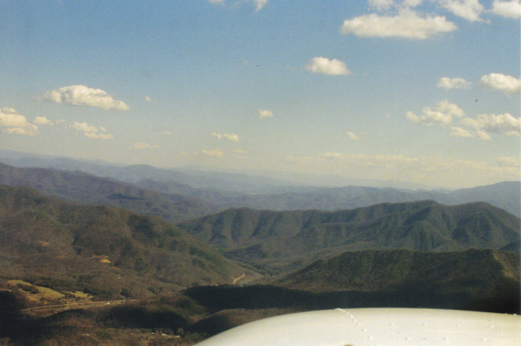
Crossing the Appalachian Mountains of Eastern Tennessee & Western North Carolina can
be challenging. There is rugged terrain that can kick up turbulence and then there are river
valleys that are much more safer to fly and are located over more populated terrain.
Planning your route prior to your flight is important when planning any flight but is crucial
when venturing into mountainous terrain.
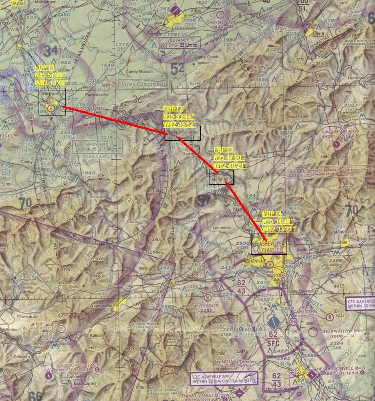
| French Broad Mountain Crossing |
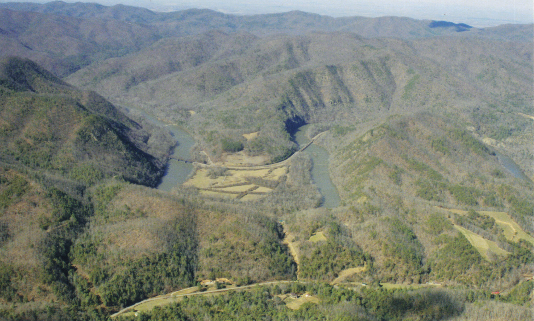
When crossing from the Tennessee Valley to the Asheville, North Carolina area, the
French Broad River can be used as a much safer route than flying directly across the
The French Broad River flows beside the Asheville Regional Airport at an elevation of
2,165' MSL. It then flows through a wide valley through the Appalachian Mountains
toward the Tennessee Valley and by the City of Newport, Tennessee at an elevation of
1,160' MSL. Though it is the pilot's discretion, flying the French Broad River Pass can
easily be navigated at 3,500' MSL. Visual meteorological conditions should exist with
good visibility and ceilings. Winds aloft at 3,000' MSL and 6,000' MSL should not
exceed 20-30 knots as recommended by many mountain flying publications.
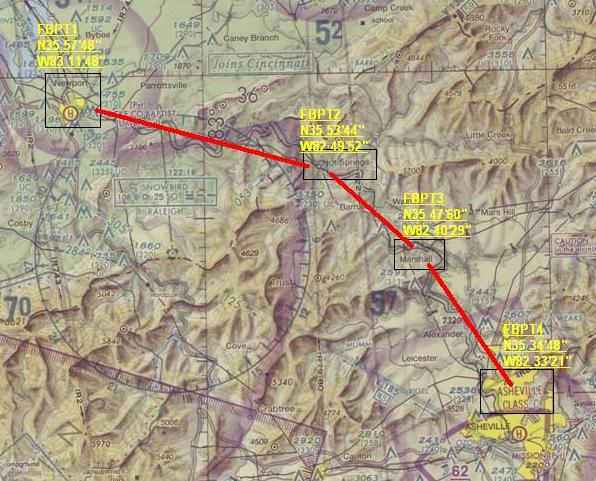
The route starts over Newport, Tennessee coordinates for Newport are N35 57' 48" / W83 11' 48". |
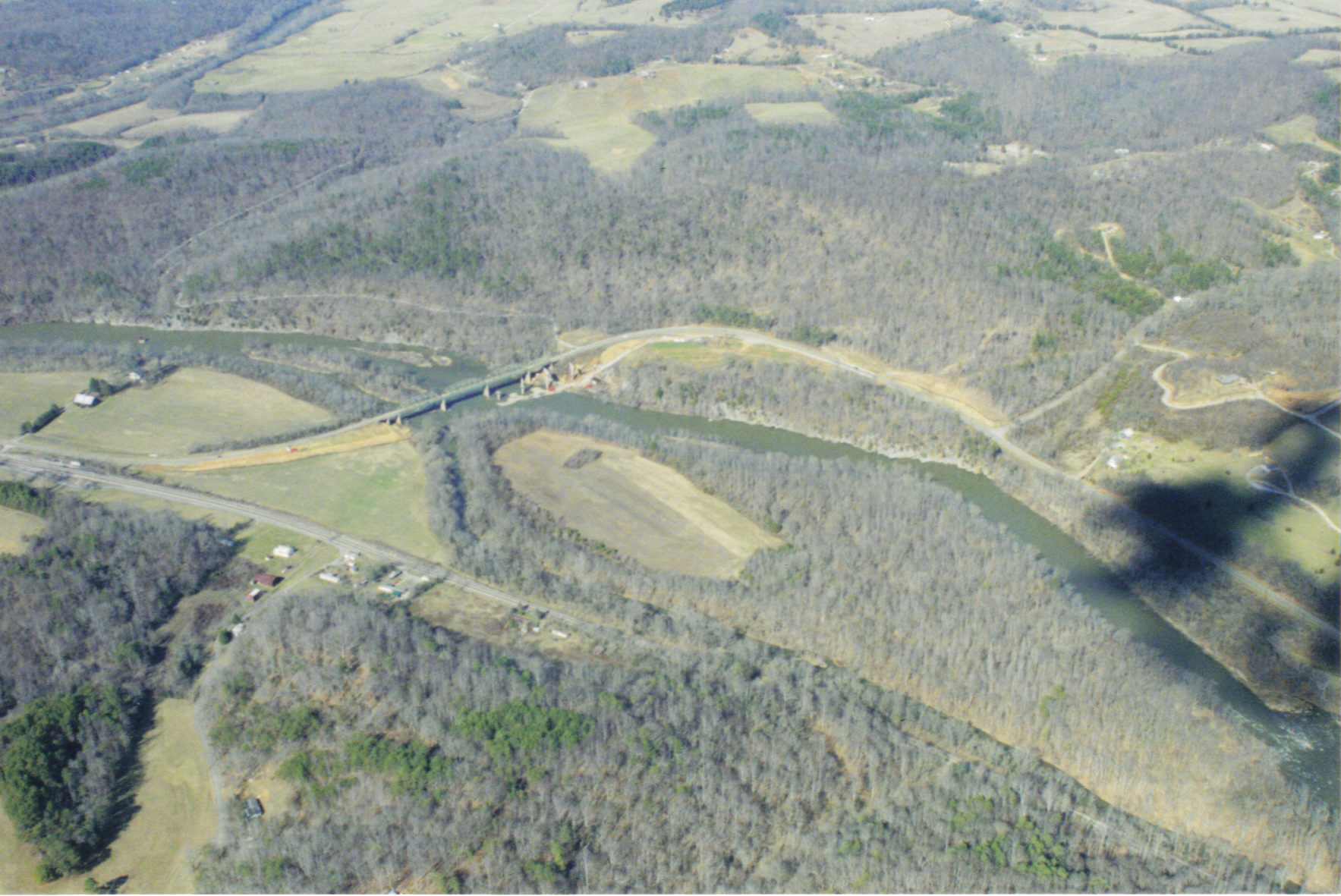
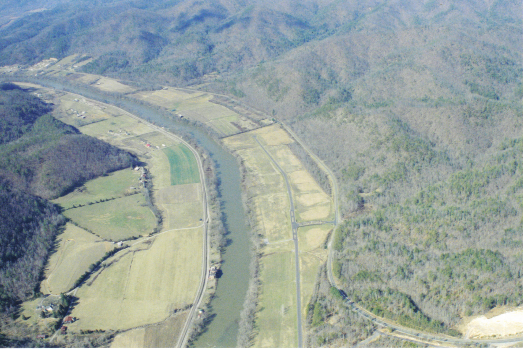
Fields line the river for much of the crossing. |
A railroad winds its way along the river with numerous railroad bridges. |
Highway 25 winds its way along the river from Newport to the Asheville area. |
Hot Springs, North Carolina is the second check point along the route. Hot Springs is home to hot springs mineral baths and is a stop on the Appalachian Trail. The elevation of this town is 1,352' MSL. The coordinates for this check point are N35 53' 44" / W82 49' 52". |

Marshall, North Carolina is the next check point along the route. The elevation of this town is 1,657' MSL. The coordinates for this check point are N35 47' 60" / W82 40' 29". |

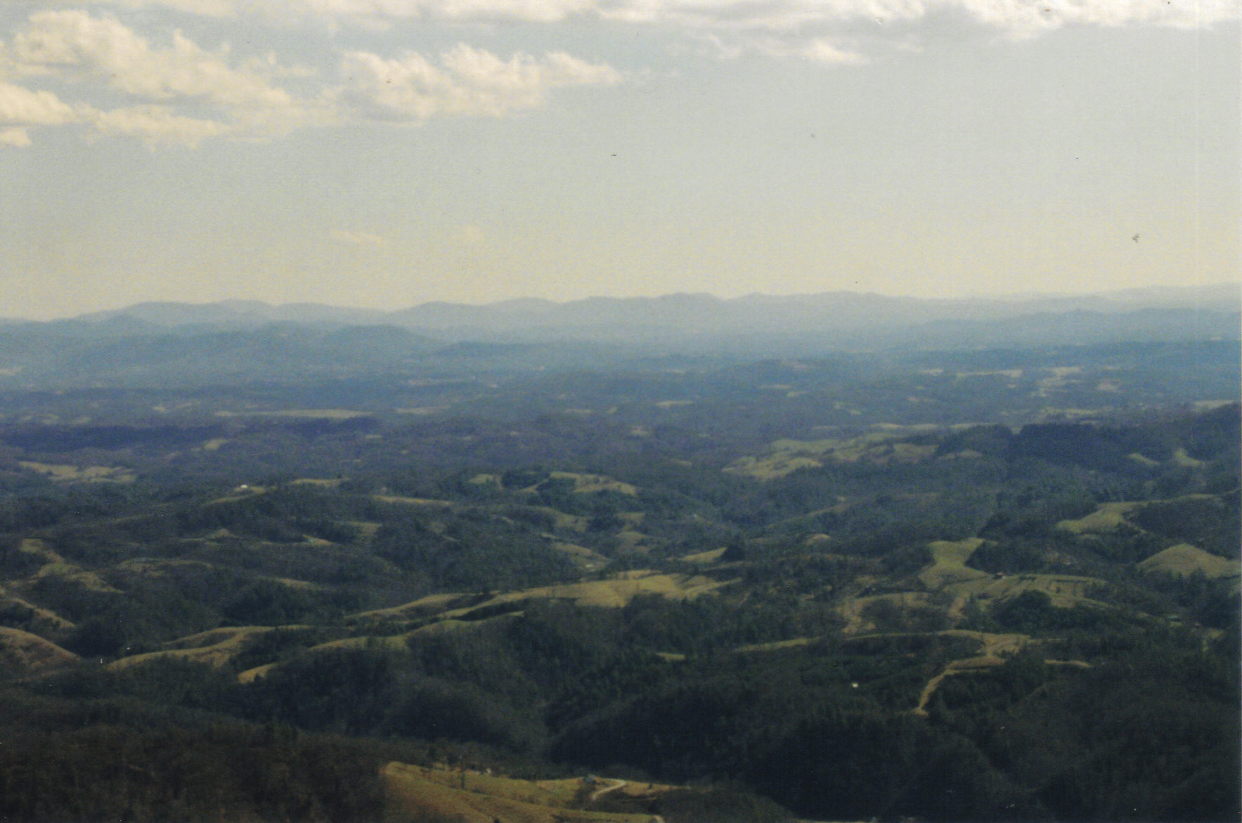
the mountainous terrain and are back over flat land. The City of Asheville will be on the horizon at an elevation of 2,134' MSL.the mountainous terrain and are back over flat The coordinates for this check point are N35 34' 48" / W82 33' 21". |
| Route Check Points To Enter Into GPS Unit City Elevation Point Name Coordinates Newport, TN 1,160' MSL FBPT1 N35 57' 48" / W83 11' 48" Marshall, NC 1,657' MSL FBPT3 N35 47' 60" / W82 40' 29" Asheville, NC 2,134' MSL FBPT4 N35 34' 48" / W82 33' 21" |
| French Broad Mountain Crossing |
| It is the pilots responsibility to verify terrain elevations, and all other necessary information before venturing along this route or on any other flight. |